|
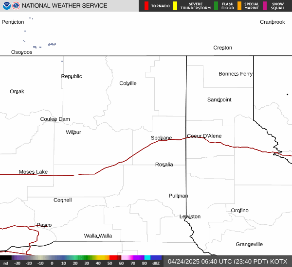
click on radar and satellite images for larger view Click here for wide area doppler radar |
|||||||||||||||||||||||||||||||||||||
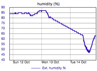
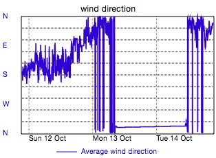
Detailed and historical data for this station. | ||||||||||||||||||||||||||||||||||||||
|
||||||||||||||||||||||||||||||||||||||


 full disk satellite |
 forecast and more |
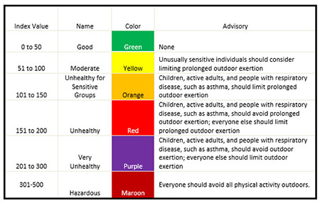 air quality |
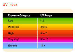 UV index |
|
| station location near 18th Ave. & Freya St. Spokane, Washington 99223 USA lat: 47.6° long: -117.3° elevation: 2208 ft |
" |
The weather data displayed on this page is collected and logged by a La Crosse Technology WS-2316 Professional Weather Center. Information is posted using WeatherCat 3 software running on an old but trusty iMac.
Questions, comments or suggestions should be addressed to: beta@daisley.net. 
|